Welcome to the Maunie of Ardwall blog

This is the blog of Maunie of Ardwall. After a six-year adventure sailing from Dartmouth to Australia, we are now back in Britain.

Thursday, 7 July 2022

Leaving Orkney and Searching for Nessie


Sunrise over Loch Ness

Our trip across the fearsome Pentland Firth, where peak tides create fierce white-water standing waves that threaten the safety of even large vessels at the wrong time, was perfectly calm. The anchorage in East Weddel Sound, next to one of the Churchill Barriers, allowed us to reach the southern tip of South Ronaldsay, 11nm away, at the optimum moment.

Our final Orkney anchorage - with the wreck of a blockship beside the Churchill Barrier

The complete absence of wind meant that, apart from a little left-over swell, the 30nm passage to Wick was an easy motor and the approach to Wick Harbour, which can be tricky in strong SE winds, was a doddle. 

The route back (in pink) to the mainland

We rather liked Wick for its industrial history and architecture, although the town centre is pretty impoverished, with lots of empty shops and a faintly depressed air.

The middle and inner harbours of Wick, with the little marina to the left

The harbour in rather busier times, with a huge fleet of herring drifters

In the heyday of the herring fishing boom, the massive harbour was built by Thomas Telford (who was also responsible for the design of the Caledonian Canal) and a new settlement called Pultneytown was commissioned by Sir William Pultney to both service the increasing fishing fleet and to provide jobs and good accommodation for Gaels evicted from the land during the Highland Clearances in the late 18th and early 19th centuries. Sir William’s legacy is an impressive set of buildings, some of which are sadly in need of restoration.

Interesting building in need of a new purpose

Managers' houses...

... and workers' cottages


Wick’s fishing boom and the 1980’s oil boom are distant memories but there’s a new industry in town that’s creating some C21 jobs; a huge offshore wind farm is being extended, so vast supply vessels are based in Wick harbour to support it.

Our onward passage from Wick to Inverness had to be re-planned slightly. The calm weather that finally followed a long period of strong winds had suddenly encouraged an armada of yachts to head towards the Caledonian Canal so it transpired that Inverness Marina was fully booked. We therefore decided to make the 70mn coastal passage to an overnight anchorage in Cromarty Firth and took a break from the motoring (no wind at all) to investigate the little harbour of Helmsdale.

The straight-line track of motoring along the coast, with a stop at Helmsdale.
Note the windfarm to the SE of Wick

Helmsdale from the land - the little man-made harbour requires a bit of a handbrake turn to enter and you need to arrive near high tide to clear the shoals

We would have liked to stay a night but the visitor's berth where we moored only has about 1.1m depth of water at low tide and we need 1.8m!

An RNLI fundraising tableau on the dockside...

.... Dianne met Gary, its creator, He put it together as a lockdown project and encourages visitors to make a donation. So far he's raised over £14,000!

The view in Cromarty Firth. A yard that previously built and serviced oil rigs is now assembling the foundations for wind turbines


On Sunday we made the final move round to Inverness and the entrance to the Caledonian Canal. It was a cracking sail in a pretty brisk wind, so we were glad to reach the calm water of the Clachnaharry Sea Lock.

The final beat into Inverness, under the impressive Kessock road bridge.
The Clachnaharry sea lock is to the bottom left of the chart


The sea lock. Maunie shares it with two Norwegian and one Dutch boat.
We've been surprised to find that British yachts are outnumbered by European ones on the canal

Graham’s dad, Geoff, joined us in Inverness for the Canal transit and, so far (three days in), we’ve had a great time in some mixed weather. The initial Muirtown staircase of four locks took us into a tranquil section; the canal doesn't leave the River Ness very far away:

A lunch stop at Dochgarroch lock, with the river to the right

Looking SW from Dochgarroch towards Loch Ness

The visitor pontoons and shore toilets / showers are excellent

Day 1 on Loch Ness and Geoff enjoys some lovely sailing

An overnight stop near the imposing Urquhart Castle on the north side of the loch


The Force 6-7 on the nose in the second half of Loch Ness the following morning  came as a bit of a surprise!

Motor-sailing against the fierce wind and choppy water

38 short tacks up to Fort Augustus at the SW end of the loch

This morning, by contrast, we had calm sunshine as we prepared to leave Fort Augustus to climb its staircase of five locks.

Looking towards the Fort Augustus locks

The large Victorian building to the left was a monastery and is now a hotel

Early morning in Fort Augustus before the crowds of tourists arrive.
The locks are left full overnight in case anyone tumbles in after overdoing things at the Lock Inn!


These locks were followed by another single lock to head into Loch Oich which is the summit of the Canal system. From there we have motored through the very leafy Laggan Avenue section to moor up just before the two Laggan locks which are the first down-hill chambers of the route.

Tomorrow we’ll pass through these, cross Loch Lochy and head down towards Fort William. We’ll be hoping that the cloud lifts to give a view of Ben Nevis as we go.


Wednesday, 29 June 2022

Westray, Stronsay, meeting another Vancouver and waiting for weather (again).


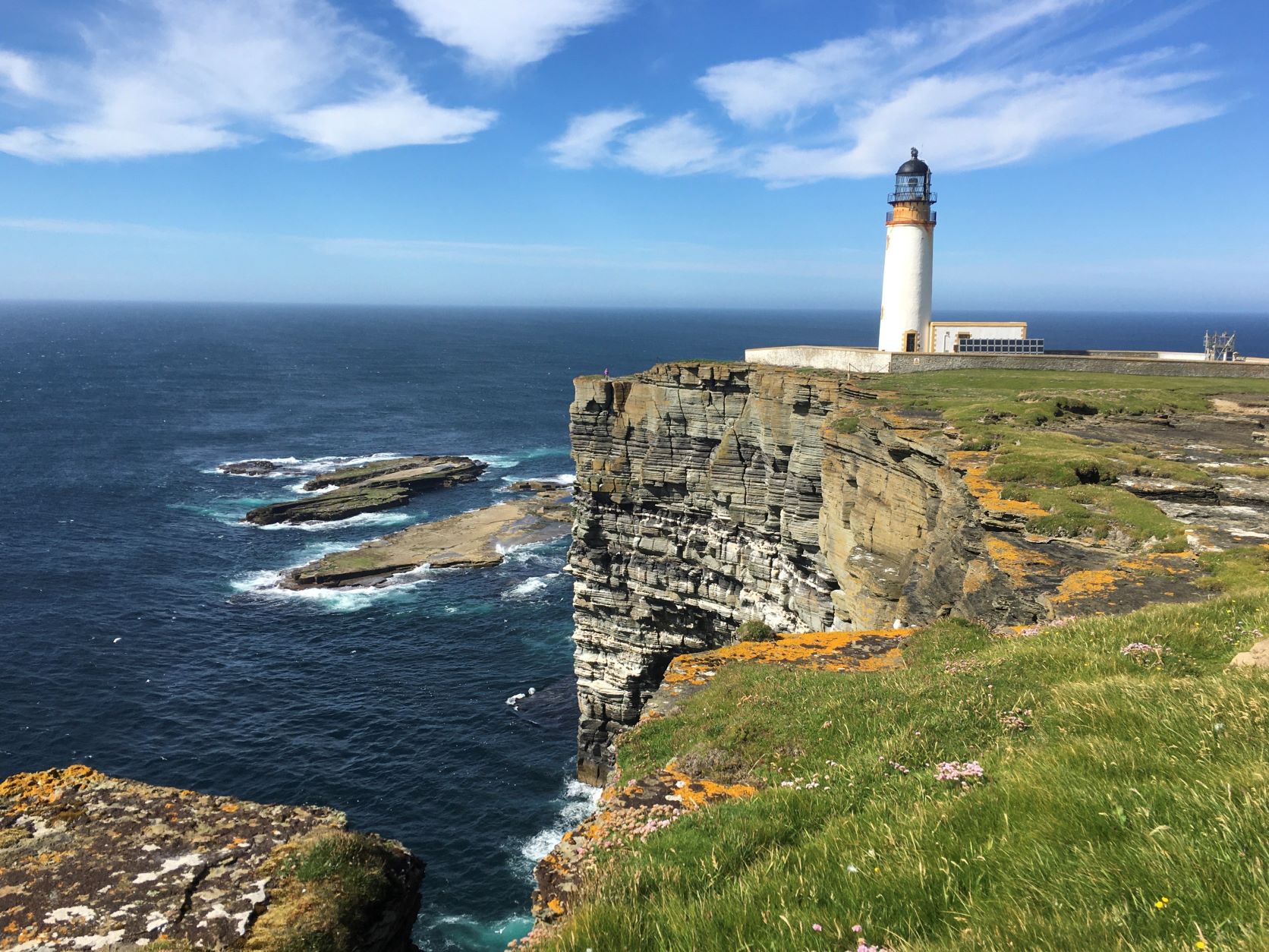
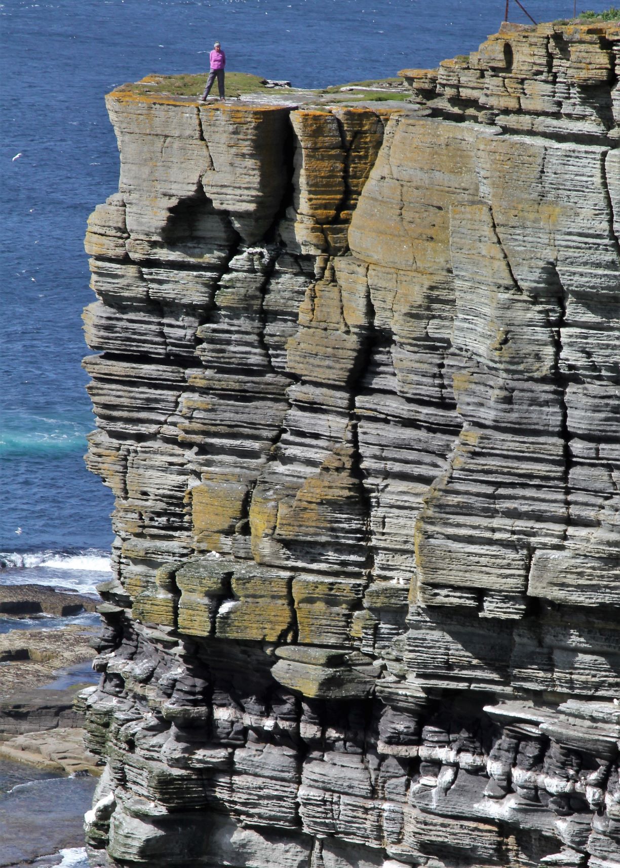
Our final day on Westray was still relentlessly windy but, once the overnight fog (known as haar in these parts) had cleared, we had bright sunshine – perfect for a long hike up to the NE corner of the island to bag another lighthouse. But first we called in at Hume Sweet Hume, a successful designer knitwear business where we chatted to the owner and then enjoyed a delicious pizza lunch at the new cafĂ©, Saintear. Noup Head light, another Stephenson design, is perched precariously close to a sheer cliff face that is home to thousands of nesting seabirds.

Lighthouse facts – the tower is 24m high but the light is 79m above sea level, Built in 1898, it was the first light in Scotland to use the concept of floating the rotating lens on a bath of mercury. It was automated in 1964 and the lighthouse keepers’ cottages were demolished shortly afterwards.


Di giving Graham palpitations - it looks as though she's a lot closer to the edge than she was!


During our island hikes we also came across this little stone-built structure on the edge of one of the beaches.


At first we assumed that it was very old but it appears to have been constructed recently with an excellent purpose:

Inside there's a bbq basket and even a bag of kindling!

The SE winds were forecast to continue for several days and the outlook for Sunday night was for them to increase to Force 6-7. The otherwise excellent little harbour and marina in Pierowell was open to wind-driven waves from that direction so we decided to get out while we could and sail the 23 miles over to Stronsay. Of course, the wind was on our nose, so we tacked (zig-zagging toward our destination) the whole way and it was a reasonably challenging sail, with some fierce tides to contend with at the end.

The red track was our route into Westray, the black track is the passage to Stronsay

Whitehall harbour is well sheltered in SE winds

The departure turned out to be a good decision because we found perfect shelter in Whitehall Harbour, alongside the substantial stone pier. Amazingly, we found that a boat already there was another Vancouver. Maude is a Vancouver 34, built the same year as Maunie, and owned by Adele and Martin whom we’d met last year at the owners’ association annual dinner in Bristol! With a much-needed easing of the wind the following day, we were able to fly the drone to get some photos of the two boats together.


The evening after Maude left (for Kirkwall – they are heading the way we came, towards the Outer Hebrides), the wind calmed completely for a few hours to give us a wonderful sunset.


A calm sunset, before the next batch of wind

Stronsay is an interesting island – it’s very flat (the highest point is only 43m above sea level) so wind is a pretty constant feature. The land is obviously very fertile, so beef and sheep farming are the main activities here. The sleepy little village of Whitehall has a small shop, a cafĂ© and a hotel. The hotel was bought by the community in May but is struggling to get going, (familiar challenges of staffing and skills availability) so hasn’t been open while we’ve been here.


 Only the larger-than-average stone houses on the waterfront hint at the island’s previous prosperity. In the 19th and early 20th centuries this was the epicentre of Orkney’s thriving herring fishing industry. When the herring season came each year, the island would have over 4000 people working on landing, gutting and salting the ‘silver darlings’ which were packed into barrels and shipped all around Europe. 

A ship loaded with barrels of Stronsay herring, c 1924

Whitehall village, at its peak, had 40 pubs and the old Stronsay Hotel boasted the longest bar north of Inverness! The boom collapsed in the 1930’s as over-fishing destroyed the once-huge stocks of fish and, with it, Stronsay’s prosperity came to an end.

Today the island is home to only about 320 people and Whitehall has a slightly dejected feel about it. However, there’s obviously a lot of effort being put in to keep the place alive and funding has been sought to try to widen its appeal to visitors (though we suspect some residents aren’t that keen on encouraging incomers!). We were amazed to find that there are four excellent electric bikes available to borrow, free of charge, so yesterday we took two of them to go and explore. We were very thankful of the battery assistance as the brisk SE’ly wind had returned with a vengeance and were able to see some of the superb coastline features.

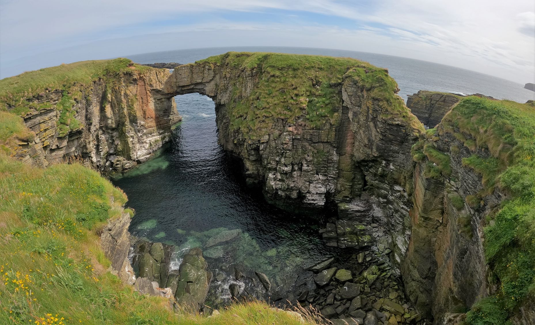
The amazing arch at the Vat of Kirbister 


Nesting Kittiwakes


We’ll be here for one more day. The wind is forecast to ease a little tomorrow, so we’ll sail east and south down to the Churchill Barriers on South Ronaldsay, ready to cross the Pentland Firth on Friday. Spot-on tidal planning will be vital for the 30 mile passage to Wick as the Pentland Firth is probably the most tidal stretch of water in Britain, with currents running at up to 12 knots if you cross it at spring tide. We will, naturally, be crossing at spring tide so our traverse of the 6-mile-wide scary bit will be timed to coincide with the least current. We’ll let you know how it goes!


Saturday, 25 June 2022

Weaving between the islands in Orkney


With the strong winds finally abated, we could leave Stromness and head out to explore some of the other islands in the archipelago - and there are plenty to choose from!


Our first target was the capital of Orkney, Kirkwall which is just 17 miles from Stomness by road but considerably longer by sea. We'd chatted to some locals who all cautioned against 'doing a west-about' - leaving the way we came, out of Hoy Mouth and northwards up the western side of the island that's called, slightly confusingly, Mainland. Apparently, after a few days of strong westerlies, the sea state would be very uncomfortable. Instead, we planned an 'east-about', sailing down through Scapa Flow and out around Lother Rock at the southern tip of South Ronaldsay. 

Once again, the pesky tides needed to he given a good looking at and we decided that the timing of leaving Stromness on a favourable tide and passing Lother Rock at slack water (rather than at 6 knot of tide that runs there at the wrong moments) would be tricky. Instead, we'd make an overnight stop at Longhope thereby converting a 17 mile road trip into a two-day voyage - it's a good job we aren't in a hurry. 


The sail to Longhope was interesting in that we passed through Gutter Sound, a place where 103 years before, to the very day, the interned German naval fleet of 34 destroyers and 5 battleships, were scuttled by their crews. With protracted negotiations between the Allies still going on, the Germans feared that at least some of their ships would be given to the French so decided that sinking them would be a better course of action!

Brisk winds and rain prevented us from dinghying ashore at Longhope, unfortunately, which was a shame as the 19th Century Martello tower and the WW2 defence battery looked like interesting places to visit. However, the following morning we had perfect conditions for rounding South Ronaldsay and then took a two-hour break to wait for tide in East Weddel Sound.


The excellent anchorage lies just to the east on one of the Churchill Barriers, built (largely by Italian POWs) to block access to the east side of Scapa Flow after a daring night time raid by a U-boat in 1939 succeeded in sneaking past block-ships sunk in the sounds. U47 scraped through, after being briefly snagged on cables strung between the blockships, and torpedoed the battleship HMS Royal Oak as she slept at anchor. The mighty ship's ammunition hold exploded and the ship capsized in only 15 minutes with the loss of over 800 of her crew.

The little island to the north of us, Lamb Holm, is where the Italian POW's built the famous Italian Church, using two Nissen huts and some very clever concrete work and amazing artwork.

Moving onto Kirkwall, we had another couple of days of windy weather (this is definitely a theme!) and, while it was great to be able to use a laundrette, shop at a large Tesco and eat at a good Italian restaurant, we were surprised at how neither of us really liked the place. Just too many people, especially when the flags were rigged:


The flags, of course, were there to welcome the thousands of passengers on the cruise ship Costa Fortuna (really!) who poured into the town to fill the cafes and tourist shops. We certainly can't blame the Orcadians for wanting to attract cruise liners - and they will have over 150 of them calling in this year between May and September - and the jewellery and art shops that line the streets do great business from them but we were glad to leave!


Finally, we had a lovely day for sailing! Blue sky and a favourable wind allowed us to fly the Parasailor for the three hour passage up to Pierowall in Westray.


It was another passage that required careful tide planning as it took us through narrow sounds between islands and past a huge new tidal energy turbine but we were delighted to find space in the tiny Westray Marina.

The 17-berth pontoon sits in the little fishing harbour across the bay from the village and we had a great hike out to the coastline to the north-west

A fine selection of anchors

The calm marina on the first evening


The beach walk got us both trying some arty photos:

'Where did he go?' by Graham

'Swirling sea' by Graham

'Beached' by Dianne

'Tangles' by Dianne

Unfortunately the weather is playing with us again! First of all dense fog, which prevented us from leaving this morning, and now a Force 5-6 wind.

A foggy start this morning

The Westray harbour

The good news is that the wind has now blown the fog away and we have sunshine! Time for more hiking!